
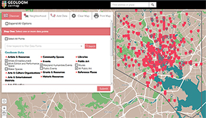
GEOLOOM is rooted in the idea that arts and culture play a significant role in fostering the vitality of a place. Neighborhood-based arts and cultural activity can have an impact on residents’ attachment to their community, the overall economic conditions in their neighborhood, and the quality of life for the entire city.
GEOLOOM will give us a better understanding of the arts and culture landscape along with the ability to view data within a broader context of demographic, real estate, and ecological information. It will help all of us in decision-making about the City’s future. Through visualization, GEOLOOM will aid cultural institutions, businesses, and elected officials by heightening their awareness of potential audiences, customers, and constituents.
The data you will find in GEOLOOM will be analyzed every year so we can successfully measure community improvements over time, identify gaps and, confidently address arts and culture needs while strengthening all aspects of the City’s social and economic fabric. We welcome feedback on the data and continuously seek to expand both the definition of arts and culture and the types of data available on the website.
 The purpose of the Central Maryland Development Review website is to provide geographic visualization of development projects and track them as they go through the review process. The points on the interactive map represent the status of the project at the time of any public hearing for which approval is required in order to obtain a building permit.
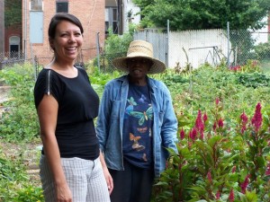 Beginning September 2012, BNIA-JFI began to create an interactive resource tool for community gardens and open spaces in an effort to timely monitoring and coordinate activities to strengthen the relationship between improving urban waters and community revitalization. This resource should be useful for leveraging community-based funding, policy development and advocacy.
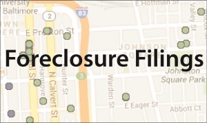 This archived website contains data and maps for Baltimore City residential foreclosure filings and ratified sales for years 2007 through 2013. The Baltimore Neighborhood Indicators Alliance collects, charts and maps the data, in addition to maintaining the site, with support from the Baltimore Homeownership Preservation Coalition. All data is public information and available from the Maryland Judiciary Case Search and Maryland State Data Center. This website does not include data on tax foreclosures.